

☘️ Le Maguet Loan
loan.le_maguet@ens-lyon.fr
loan.le_maguet@ens-lyon.fr
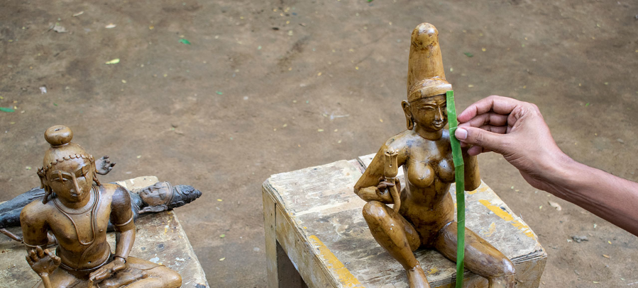
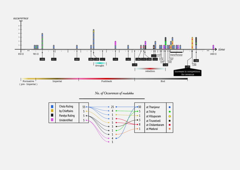
Maṭakku (literally, 'fold') is a system of land measurement used under the Cōḷa rule (9th -13th century CE) in medieval Tamilakam (today's Tamil Nadu, Kerala, Puducherry, Lakshadweep, Andhra Pradesh, Karnataka). It emerged during the Cōḷa rule and ends shortly after the collapse of the dynasty. It is directly correlated to the rise of the number of Brahmadeyas within the main locus of the Cōḷa country.
The maṭakku system informs one about the quantity and quality of a certain piece of land. Its land ranking system characterized them according to their expected productivity, regardless of its actual size and labour force working on it. Maṭakku was the key reference for computing taxes on cultivated lands (katamai). Fixing a standardized way of valuing land provided the royalty great power and control over its area of influence. Although the practice of ascribing more value to productive lands was not unique, the social importance given to the new blended area measure was.
Rajaraja Cōḷa (985 - 1014) institutionalized maṭakku , and introduced a standardized tax rate of 100 kalam per veli, i.e. roughly a hundred million grains of paddy. For this, he introduced a new standard measuring rod: tiruvulakalantan kol, literally 'the rod of the one who measured the world'. This rapprochement with the divine facilitates the process of imposing this new system of measurement over the diversity of local practices, and strengthen his power. To compute the maṭakku area of a land, the village accountant would need the local land workers to measure the lengths of the sides of the land to gauge the physical area or parappu (literally 'spread').
The accountant the estimates the quality of the land by grading it with respect to a standard land. This standard land is thought of as a land of highest quality, in terms of productivity of grains, and is assigned the grade 1. Lands with less favourable agrarian conditions were assigned grades like 2, 3, 4, 5, etc. Considering this grade, along with the physical area of the land, the accountant would compute the notional area called the Maṭakku-nilam (maṭakku land), as he is the certified person to conduct this type of calculations.
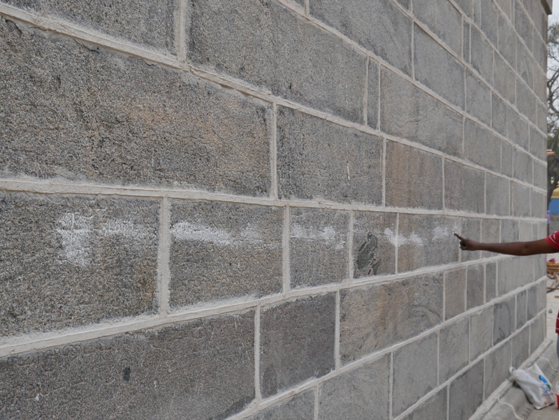
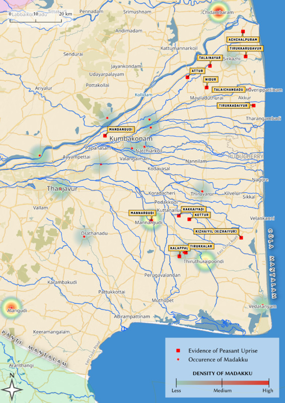
Let's dive into a meticulous record of maṭakku dating 1186 CE. Here, the matakku area of the given land is eighty times lower than its actual area. This is an occurrence of temple-brahmadeya, a gift of land to a temple that brings honour and power to the landowner. The record starts off with a eulogy to the king, almost depicting him as divine. For instance, it has been inscribed that 'clouds were abundant and the fertility increased' under his rule.
Even though the village accountant is central for every calculation, transaction, or record for the maṭakku system, computing the folded area of a land involves other equally important actors. First, the measurement of the land using the measuring rod is made by the corvée workers of that land. Second, the landowner, often belonging to an educated upper or middle caste, can sometimes negotiate with the accountant, or at least understand the details of the computation as the accountant performs it out loud.
It could be argued that maṭakku , rather than being an original accounting tool for economic purposes, was the key for the socio-economic organization of society at that time. This system centralized the power of computing taxes, wages, corvée labour due, money due, and so on, into the hands of a few highly educated representants of the royalty. The taxation system that it sustained had multiple faces. The tax could be paid in gold for some, but many landowners had to pay their taxes in grains. This caused much instability as droughts and poor harvests could result in the land being donated or auctioned, and the tenants and labourers being expelled. For those failiing to pay taxes, labour without remuneration called vetti, became a way of paying them.
As a vast land with a low grade with many labourers would get a relatively small folded area, and thus little importance, the matakku system hides the value of labour behind a quite abstract number. Not to mention the uniqueness of the measured land is not accounted for in the folded area. In the end, the matakku system builds a social hierarchy in the same way as grades rank students at school. More than ranking owners with respect to the value of their land, it also sustains a violent apparatus of taxation that forces many people towards corvee labor and subordination.
Unfortunately, the promise of justice brought by the standardization of measures, standing as a way to resolve conflicts with precision, among people using different instruments of measure, has never been fulfilled. The matakku system remained very opaque, and it was thought as a way to manipulate less educated people. The computation itself was quite arbitrary, as it lay with the accountant to choose the grade of the land and the mattu scaling factor he would apply to the final result (3/4 or 1/4 + 1/8).
It was also known that paying for the measurement meant having more control over the result. Not to mention negotiations that allowed landowners to pay less taxes. In times of droughts, the middle-caste land owners would gather to resist the royal ruling, and the agrarian labourers would also take part in revolts. For example, in 1177, an important revolt took place, manifested by many stone records of resolutions taken by the lower and middle caste against the royal ruling upon property. They revendicated some power in the managing of ownership, fully controlled by Brahmins at that time, as well as the inheritance of the land to wife and children.
Maṭakku was also instrumental in the quantification of labour. Its land ranking system further enabled extraction and several measures of control: the standardization of water redistribution (cennir potuvinai), measuring instruments, and new standards of quality revolving around productivity. As the 'matakku area' of a land was known to estimate the rentability of conquering a land, we can arguably think of the system as a dehumanizing accounting tool that served the rich and powerful.
Even though matakku disappeared with the crumble of the Cōḷa rule, the socio-political organization induced by the system remained. What this story shows is how mathematical practices can be crucially determined by power structures and be shaped in order to sustain or strain a socio-economic hierarchy.